| Home | Open Account | Help | 385 users online |
|
Member Login
Discussion
Media SharingHostingLibrarySite Info |
Western Railroad Discussion > cantera loops accessDate: 04/14/14 16:46 cantera loops access Author: fbe This is beginning to look like an overnight in Dunsmuir tonight.
The best thing tomorrow would seem to be morning trains moving before the signal dept gums things up south of Chemult again. I might like to try the Cantera loops. Best I have is I-5 to the Lake St exit then west. Any better ideas? AMTK 14 might be through??? Motel recommendations? Doesn't have to be fancy. Thanks. Posted from Windows Phone OS 7 Edited 1 time(s). Last edit at 04/14/14 17:23 by fbe. Date: 04/14/14 17:55 Re: cantera loops access Author: Torisgod I can't be seen as an authoritative source on how to access the Cantara (not Cantera) loops, but I'm pretty sure there is a gravel road that leads up the canyon from central Dunsmuir to the loops.
As for motels, just about the only lodging establishment in central Dunsmuir is the imaginatively named Dunsmuir Inn and Suites, a few blocks north of the train station, it's fine, not great. Well priced. Amtrak #14 normally comes through Dunsmuir at about five AM, but rest assured, it will surely be late. Happy rails to you! Tor in Eugene Date: 04/14/14 17:59 Re: cantera loops access Author: railpix Hey Alan,
Have had good luck staying at Cave Springs. If you really want to sleep in a (caboose?), Railroad Park south of town probably is available. If not maybe Bob Morris has space in his back yard! :) John Shaw Date: 04/14/14 18:22 Re: cantera loops access Author: fbe John,
Probably more civilized in Dunsmuir than Old Mill, ID, eh? I did not bring a tent or sleeping bag this trip but if Bob allows interlopers I will bring a growler of one of Missoula's finer ales and we can do slides after dark. Posted from Windows Phone OS 7 Date: 04/14/14 19:19 Re: cantera loops access Author: sundance Cantera Loop
Head north on I-5, take Hwy 89 exit, right after you merge take first right and stay right.follow till you come to a fork,stay right over freeway, follow around and down, you will see the crossing gates at Azalea Rd.Cross over and follow to the next fork stay right down the hill to the loop. Steve Date: 04/14/14 20:05 Re: cantara loops access Author: Evan_Werkema The lower horseshoe is Cantara Loop, and the route Steve laid out is the one I've used. A dirt road off the paved Cantara Loop Rd. leads to a grade crossing in the middle of the curve just past the bridge over the Sacramento River.
http://goo.gl/maps/lYqI2 The dirt road has a gate, but it was open when I visited last month. The video below shows a northbound train of empty centerbeams at the crossing. The photo shows the plaque at the crossing. The upper horseshoe is Sawmill Curve, easily accessed just off Mott Rd. http://goo.gl/maps/QZPOG The one time I tried to shoot a train on Sawmill Curve, the surrounding trees made it difficult to get a shot that demonstrated it was a horseshoe and not just some curve in the forest. I'm just a carpetbagger, however - for the really good angles, you'd have to ask Photobob. Edited 1 time(s). Last edit at 04/14/14 20:07 by Evan_Werkema. 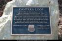 You must be a registered subscriber to watch videos. Join Today! |