| Home | Open Account | Help | 300 users online |
|
Member Login
Discussion
Media SharingHostingLibrarySite Info |
Western Railroad Discussion > Maps that show the US infrastructure, WaPo articleDate: 01/09/18 17:31 Maps that show the US infrastructure, WaPo article Author: jkchubbes "Six maps that show the anatomy of America’s vast infrastructure"
By Tim Meko Dec. 1, 2016 https://www.washingtonpost.com/graphics/national/maps-of-american-infrastrucure/ I came across this article this morning on Instagram, its over a year old so I'm not sure if it was shared here or not but I found the two railroads maps interesting. I'd be curious to know how recent that tonnage data is coming out of the coal fields.  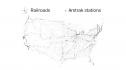 Date: 01/09/18 17:38 Re: Maps that show the US infrastructure, WaPo article Author: howeld I would guess the tonnage is about 10years old or so. Clinchfield railroad is showing similar tonnage as the Chicago mainlines of CSX and NS so has to be from the high point of coal loadings around 2008.
Posted from iPhone Date: 01/09/18 18:54 Re: Maps that show the US infrastructure, WaPo article Author: MEKoch The old ACL in southern NC and SC is very light as well.
Date: 01/09/18 20:39 Re: Maps that show the US infrastructure, WaPo article Author: MojaveBill How about a map showing value of freight carried, which should be more representative of current railroading...
Bill Deaver Tehachapi, CA Date: 01/09/18 21:23 Re: Maps that show the US infrastructure, WaPo article Author: czephyr17 MojaveBill Wrote:
------------------------------------------------------- > How about a map showing value of freight carried, > which should be more representative of current > railroading... Yes, that map would be quite different. I don't think I have ever seen one. I think I have seen maps of units moved which would show activity better. Date: 01/09/18 21:35 Re: Maps that show the US infrastructure, WaPo article Author: Bob3985 That map definitely displayed the Powder River coal tonnages.
Bob Krieger Cheyenne, WY Date: 01/10/18 08:36 Re: Maps that show the US infrastructure, WaPo article Author: march_hare Interesting to see that the UP's lines to both LA and Seattle/Portland show heavier traffic than the Overland Route. I would not have guessed that.
Date: 01/10/18 09:15 Re: Maps that show the US infrastructure, WaPo article Author: spwolfmtn march_hare Wrote:
------------------------------------------------------- > Interesting to see that the UP's lines to both LA > and Seattle/Portland show heavier traffic than the > Overland Route. I would not have guessed that. Yeah, I have to wonder about the accuracy. It also shows the BNSF main line (former GN) between Spokane and Everett (via Stevens Pass) to be the same as the BNSF main line between Spokane and Pasco. All of BNSF loaded bulk trains (grain, coal, oil) runs via the line through Pasco while the line via Stevens Pass is primarily intermodal (and is far less busy than the line via Pasco). Definitely a huge difference in tonnage volumes between the two lines. Also the BNSF northern transcon line doesn't show in a very bold font (its heavy with grain and oil, aswell as intermodal), and the MRL gets a good deal of coal, grain, and a little oil. Both those lines you'd think would be shown as heavier tonnages. |