| Home | Open Account | Help | 285 users online |
|
Member Login
Discussion
Media SharingHostingLibrarySite Info |
Steam & Excursion > Map to Cass via Cumberland from NortheastDate: 09/15/20 11:59 Map to Cass via Cumberland from Northeast Author: PlyWoody Cass Scenic RR is hard to reach without climbing over mountain ridges. Now since I-68 has been built which cut through an entire mountain you can avoid all of those ridges by leaving I-81 near Hagerstown and going west on I-68 to west of Cumberland where there are several chain motels. Cass is only two hours southwest.
Take US 220 southwest from West Cumberland via Keyser and then leave 220 to route 972. 972 is joined by US 50 but shortly leave 972 onto route 93. Rt 93 ends at Rt 42 and turn left. Go 4.92 miles and leave 42 with a sharp right turn onto Jordan Run Road. Continue south on Jordan Run Road which is joined by #15 on a left curve and in 4800 feet will end at Route 28/55. Stay on Route 28 the rest of the 34 miles to Franks and Durbin. Cass is just down the road. Visit Durbin and check out the Heisler and ride the Rocket. This route are all fully paved roads good for maximun legal WV speed and are void of any traffic, Saw two coal truck once but straight roads are easy to pass. Route 28 is a great running road but 16 miles from the end at Bartow / Frank it climbs up and over a high ridge into Pocahonias County and drops into valleys that were full of logging railroad that fed a mill at Franks. Have a great trip. Been to Cass 24 time. Correct the note below in map as it is a sharp right turn from RT 42 into Jordan Run Road. This is the hardest point to find so check the 4.92 miles on rt 42. Edited 9 time(s). Last edit at 09/15/20 21:16 by PlyWoody. 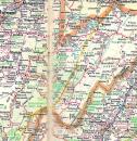  Date: 09/15/20 13:37 Re: Map to Cass via Cumberland from Northeast Author: andersonb109 Thanks for posting this. It's very timely as I plan to drive the Lincoln Highway (to complement my just completed mid west-western portion) to Cass from Lancaster, PA in November to reach their annual Photographers Special. I just spoke with them today and they said they sold out so quickly they have even added additional dates. Everything is set to go as planned. Wait. I thought some here said it was unsafe attend? So much for the gloom and doom sayers who wouldn't consider going near the place. The return drive is to Cumberland to take Amtrak back to Toledo as it just happens to be running the required day.
Date: 09/15/20 14:19 Re: Map to Cass via Cumberland from Northeast Author: jmhemmer I suspect that you mean I-68 to Cumberland, not I-70, which wanders off into Pennsylvania from the beginning of I-68 near Hancock, MD. Drove it last week. Thanks for all the detail beyond Cumberland, though; very useful.
Date: 09/15/20 16:21 Re: Map to Cass via Cumberland from Northeast Author: Appalachianrails What additional dates are you talking about? There is only one set of dates for Heritage Weekend activities.
andersonb109 Wrote: ------------------------------------------------------- > Thanks for posting this. It's very timely as I > plan to drive the Lincoln Highway (to complement > my just completed mid west-western portion) to > Cass from Lancaster, PA in November to reach their > annual Photographers Special. I just spoke with > them today and they said they sold out so quickly > they have even added additional dates. Everything > is set to go as planned. Wait. I thought some > here said it was unsafe attend? So much for the > gloom and doom sayers who wouldn't consider going > near the place. The return drive is to > Cumberland to take Amtrak back to Toledo as it > just happens to be running the required day. Edited 1 time(s). Last edit at 09/15/20 16:28 by Appalachianrails. Date: 09/15/20 17:39 Re: Map to Cass via Cumberland from Northeast Author: bigsavage Having driven the northern half of this route before, its a good direct route.
I do question the 2 hour drive time from Cumberland, traffic lights, pokey locals, and congestion from Cumberland to Rawlings, MD., and then through Keyser, WVA, can eat up the better part of an hour. I would say 2.5 hours from Cumberland. Weather conditions are another unknown factor. Date: 09/17/20 08:45 Re: Map to Cass via Cumberland from Northeast Author: dschlegel Thanks for posting this, was just at Cass this past Saturday.
We went east to Staunton for the night so this wouldn’t have worked, but I will definitely run this route on my next trip to Cass! Dan Posted from iPhone |